
Ephemera
Old photos of Smyrna
The date of the oldest photo of Smyrna is not known, but it may have taken place at the time of the Crimean War (1853-1856) when photography started becoming more widespread, but still rudimentary. Below is a selection of images from this period till around 1900, though in most cases no date is indicated in the image, clues in the photos have to be used for an educational guess. Grateful for the analysis help from Achilleas Chatziconstantinou and George Poulimenos.

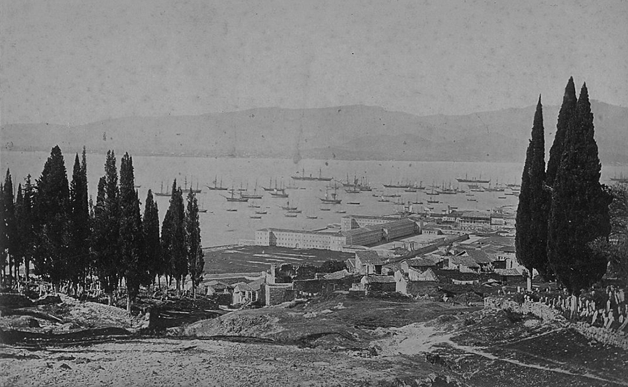
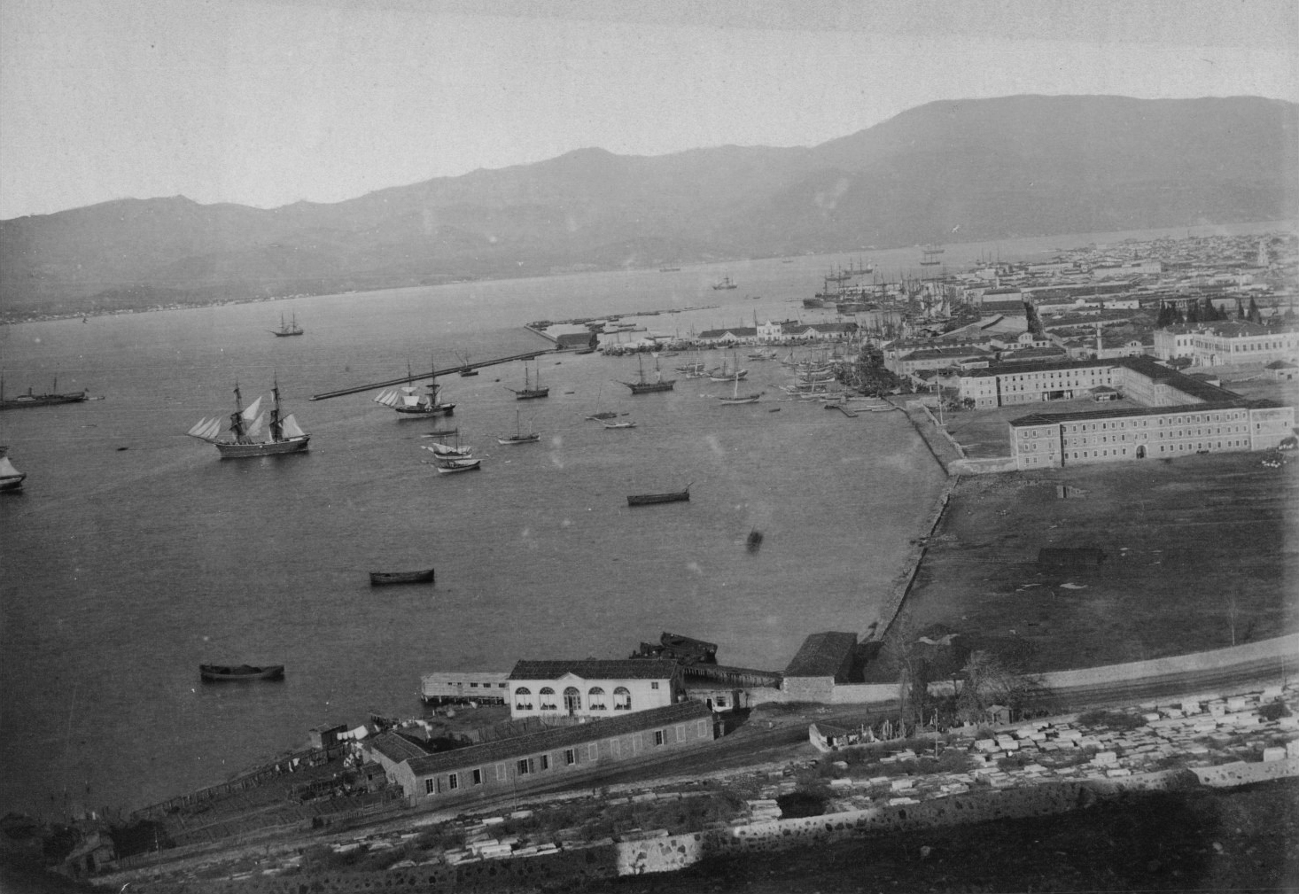
The prominent set of buildings near the shore are part of the Sarıkışla military barracks built in 1829, destroyed in 1955. To the right of it is the Ottoman army exercise field, and the tents belong to the soldiers exercising. The structure on the hilltop is the remains of the last windmill on Değirmendağ (windmill mountain) built near the former Asclepieion (healing) and the Zeus Akraios temples whose marbles were plundered for stone lids of the nearby Jewish cemetery (visible above the cluster of tents on the hillside) as well as dwellings in the area, and some of those marbles are still to be found in gardens etc.

View of the Sarıkışla military barracks with the tombstones at the slope of the Bahribaba hill marking the location of the vast former Jewish cemetery. Photograph taken by Félix Adrien Bonfils who was a French photographer and writer who was active in the Middle East. He was one of the first commercial photographers to produce images of the Middle East on a large scale and amongst the first to employ a new method of colour photography, developed in 1880. Bonfils died in 1885 so this photo and others of his is clearly before this date.


Photos-stich of the above 3 photos, looking towards the Turkish districts of Smyrna. Apparently the camera was on the Hagia Fotini belfry. The building in the middle is the Orthodox church of Hagios Georgios Exokastritis. In front of it is the roof of Evangeliki Scholi (Evangelical School) and its associated Museum building. Below perhaps the earliest photo taken of central Smyrna by Rubellin taken around 1860. Bell ringing was allowed for Christians in the Ottoman Empire after the 1856 Imperial Reform Edict. The construction of bell towers gradually followed after so the tower visible there is not from a church but likely the watch-tower for the former British or Austrian consulate in the area.


Café Eden was not destroyed by fire. It was changed beyond recognition at various stages. The building, much changed, still existed after 1922. Behind and to the right of the main building is the stage of Eden summer theatre, a short-lived enterprise that along with the famous Eden baths across the quay boulevard added to the recreational character of the venue. The above 11 sets of photos of central Smyrna are from the partnership of Jean (Johannes) Sébah and the Frenchman Policarpe Joaillier, established in 1888. The studio flourished and Sébah & Joaillier were named as the official photographers of the Ottoman Empire by the Turkish sultan. In the early 1900s Joaillier returned to Paris and Sébah continued his work in Constantinople.

A section of the old quai of Smyrna (before 1869) where the Austrian Lloyd Offices were located. This is the so-called ‘Karolos Omiros’ (‘Homére’) building, which was used by the Austrian Lloyd shipping company, as seen by the ‘L’ on the flag. In order not to demolish this building when the quay was constructed, the Rue Parallele (Ikinci Kordon) was not exactly straight in front of it, it had a wide angle corner just behind Hotel Kraemer.

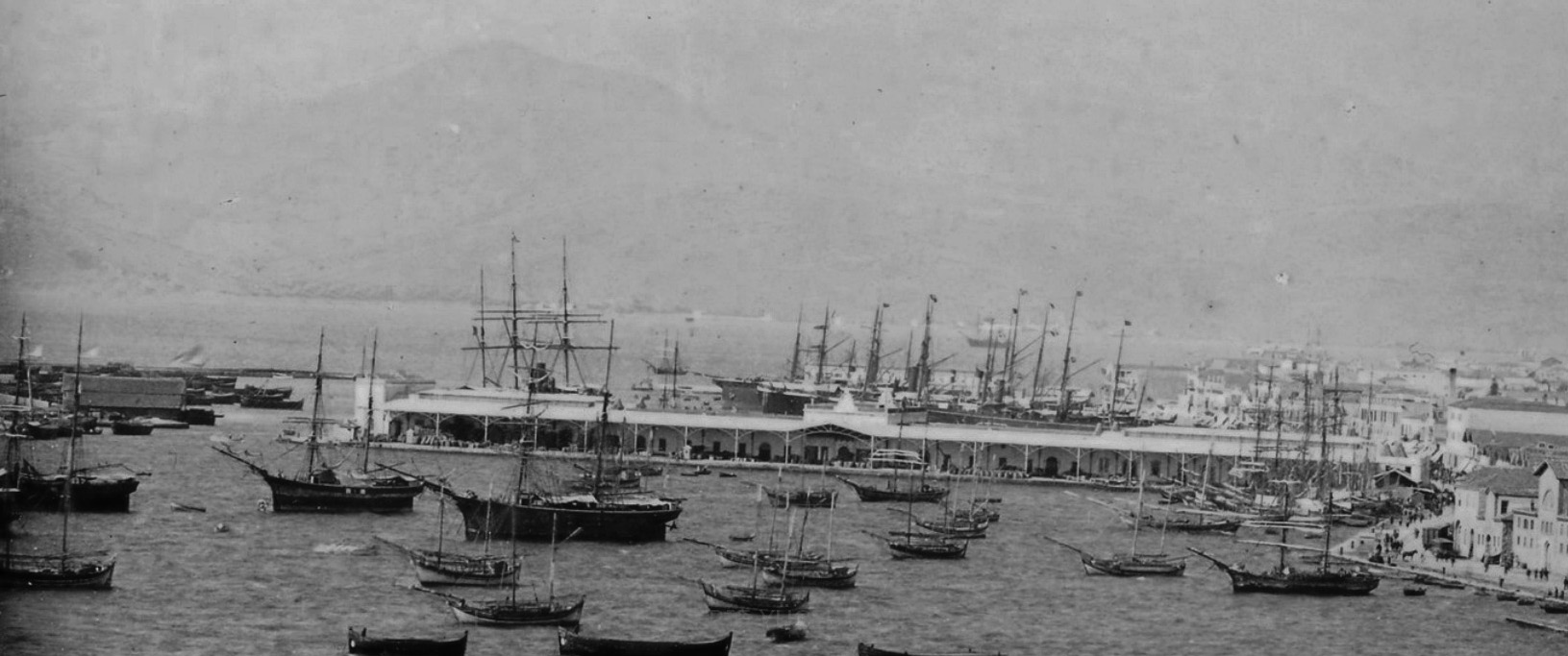
According to editor M. Yavuz Corapcioglu the Rubellin Father and Son were of French origin and operated the Photographie Parisienne studio in Smyrna in the 1870s and 1880s. They seem to have photographed extensively throughout the Middle East, especially the region of Turkey. The photo is dated around 1876-78. The nine warehouses that are shown situated tangentially to the Customs’ Pier (the actual Customs have not been constructed yet) belonged to the Société des Quais de Smyrne, the company that built the quay, operated the harbour and leased them to merchants such as the Aliotti Bros.

These warehouses were at Beyler Sokak (Milli Kütüphane Cd.). In the distance, the side of the Konak building can be seen and in the foreground the tramway tracks of the Göztepe line.

Interior view of these warehouses giving a rather chaotic impression, so perhaps at the end of their working life?

This is the Maritime train station, across the Customs’ Pier. The building ceased to serve as a station around 1900 and was then leased to the Smyrna Fig Packers Ltd. syndicate.

Looking from the opposite direction at the former custom warehouse with the ‘Smyrna Fig Packers’ company warehouse on the right, as seen with the lettering. The building to the left is the Central Fishmarket.

Grand Hotel d’Egypte operated on this spot between 1881 and 1887, so this is a probable date span of the photo. By 1922 the building hosted Grand Hotel Paradisos and although it was affected by the Great Fire, it still survives, though in a very poor state.

Caravan Bridge photographed around 1880-1890 by the Swedish photographer Guillaume Gustave Berggren (1835-1920). Below this ancient bridge seen from another angle.


Series of photos from the Sultan Abdulhamit IIs commissioned photo albums across the Ottoman Empire, here showcasing examples of Smyrna and region. This appears to show the outlying region to the south-west of the city, perhaps equating to the zone around Üçkuyular (Uçracti) beyond Güzelyalı (Kokaryalı), about 10 km soutwest of the centre of the town. The wider monumental collection portrays the Ottoman Empire during the reign of one of its last sultans, Abdul-Hamid II. The 1,819 photographs in 51 large-format albums date from about 1880 to 1893. They highlight the modernization of numerous aspects of the Ottoman Empire, featuring images of educational facilities and students; well-equipped army and navy personnel and facilities; technologically advanced lifesaving and fire fighting brigades; factories; mines; harbors; hospitals; and government buildings. Most of the places depicted are within the boundaries of modern-day Turkey, but buildings and sites in Iraq, Lebanon, Greece and other countries are also included.

The neighbourhood of Güzelyalı looking south-west.

The neighbourhood of Güzelyalı looking north-east towards Göztepe (Enopi) hill and the city beyond with a caravan train in the foreground and a Greek Orthodox Agios Pantelemion church in the background, that no longer stands.

Sea-side mansions in Güzelyalı. Virtually none of these survive today, the sea has been filled considerably and high rises dominate merging the urban fabric with the greater Izmir metropolis. In former times this neighbourhood was favoured by high ranking Ottoman officials and well-to-do minorities including Armenians and Levantines.

Güzelyalı shoreline.

Karataş (Kallithea) neighbourhood shoreline with the city of Smyrna and bay in the background. In former times Karataş had a significant Jewish population.

A photo from a similar period appearing to show the same large bathing cabin close up - allowing for ladies to bathe within the structure so completely invisible to outsiders - with what looks like a boat under construction in the foreground.

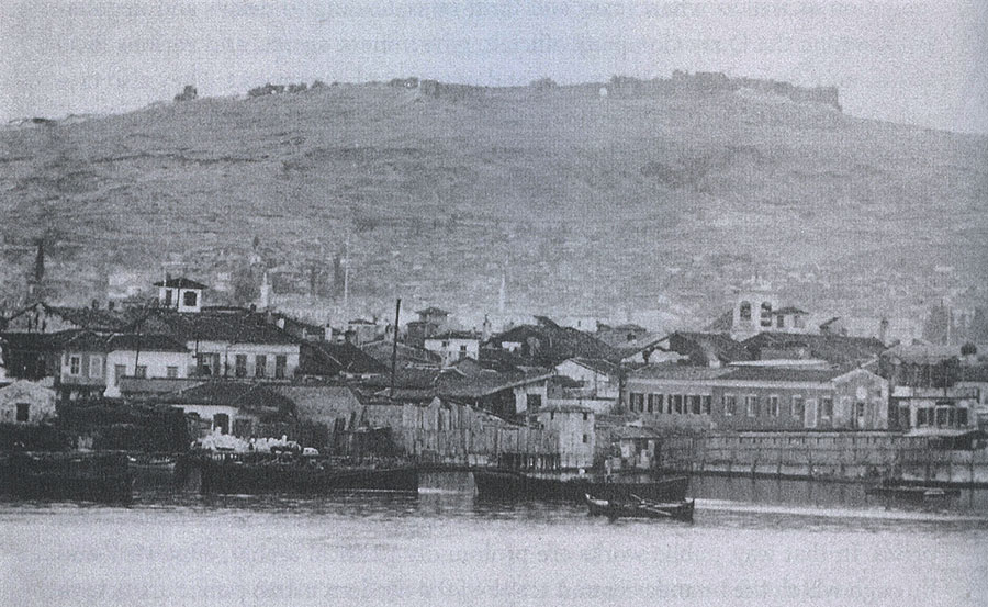
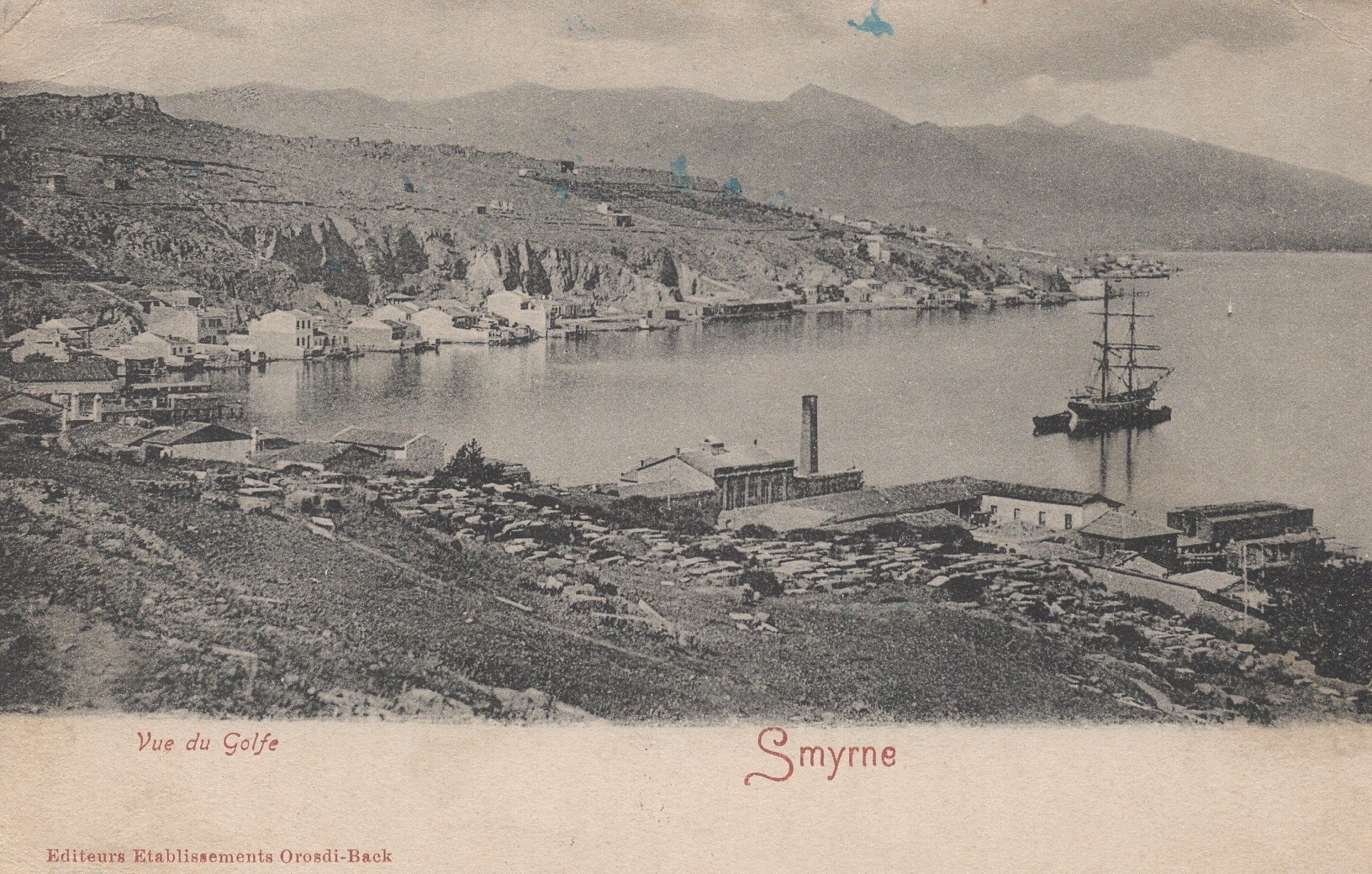
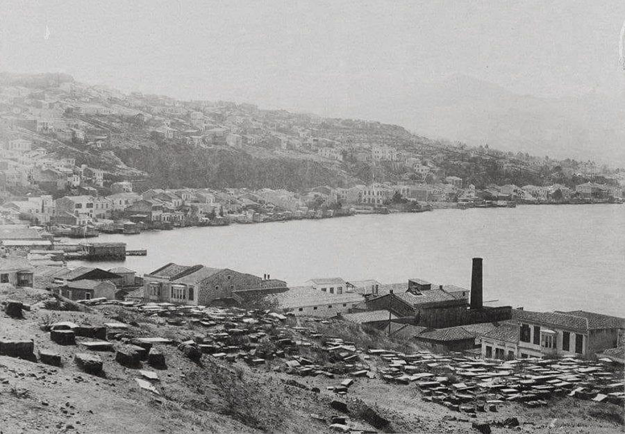
Ferry on the pier at Karataş with the old Jewish cemetery (Bahribaba / Maşatlık) on the hillside beyond The cemetery no longer exists. The postcard below possibly from a slightly earlier time (1870s?) showing the same bay from the landside. The chimney belongs to a acorn processing factory. The photo below that is possibly from the 1890s as seen by the increase in housing all along.

Looking from Bahribaba hill (English garden) towards Konak and the former barracks of Sarıkışla built 1829, destroyed in 1955, on ground gained from the sea by landfill.

The rudimentary shipyard / caulking shop (kalafathane) just before Konak - a photo attributed to Henry-René d’Allemagne (1863-1950).

The customs’ house is situated in the middle of the customs’ pier. What is important about this photo is that we see the original customs’ south dock, before the construction of Vallaury’s new warehouses in 1909.

The custom’s house.

The pier for the small steamboats to the suburbs.

This is the old passenger customs (Pasaport) building, not the commercial customs building further south.


The ‘English’ pier at the northern end of Punta with rail connection to the interior, part of the Smyrna-Aidin Railway company.

The inner section of the bay of Smyrna with the settlement of Bayraklı in the distance and an acorn processing factory in the foreground in the area of Turan (Agia Triada) with what appears to be a boat repair yard within the compound.


Karşıyaka (Cordelio) with bathing cabins at the end of individual piers.

Karşıyaka (Cordelio).
