 |
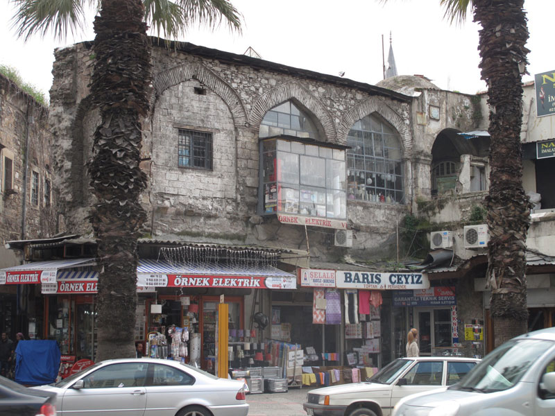
Possible remains of a Knight’s Castle within the old port of Izmir. Going towards the Kemeraltı Bazaar and before reaching the Hisar Mosque you can see the remains of the old walls which reminds us the years when Izmir was divided in two and when Latins and Genoeses build in 1344. St. Pierre Castle and Church. In this epoch the Turcoman Aydınogulları were dominating the today’s Kadifekale site [Mount Pagus]. The situation is complicated by the fact that in Ottoman times this was near the location of Selvili Han, and so the remains may be of this building, though possibly using the same foundations / material?
 |
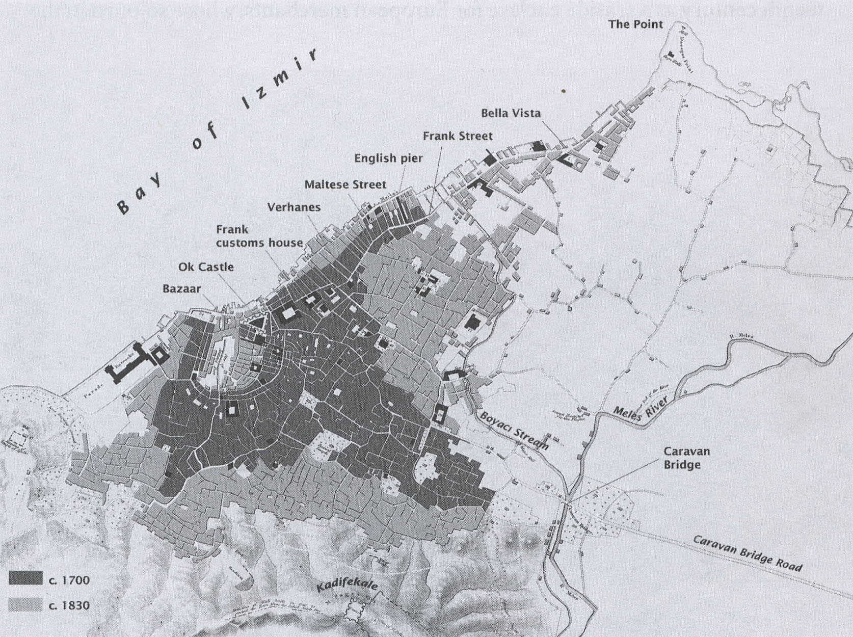 |
The map of 1836 by Lieutenant Thomas Graves shows the castle’s location. Another map of reference is the Storari map of ca. 1850. Later maps don’t show the castle, which was torn down in the 1860’s. It seems probable that this structure was large enough to have outer and inner walls, and the name of the bordering street ‘soğan kale’ [onion castle also the Greek name: krommydokastron - onion-like castle] points to this possibility and so these walls could be part of the old citadel?
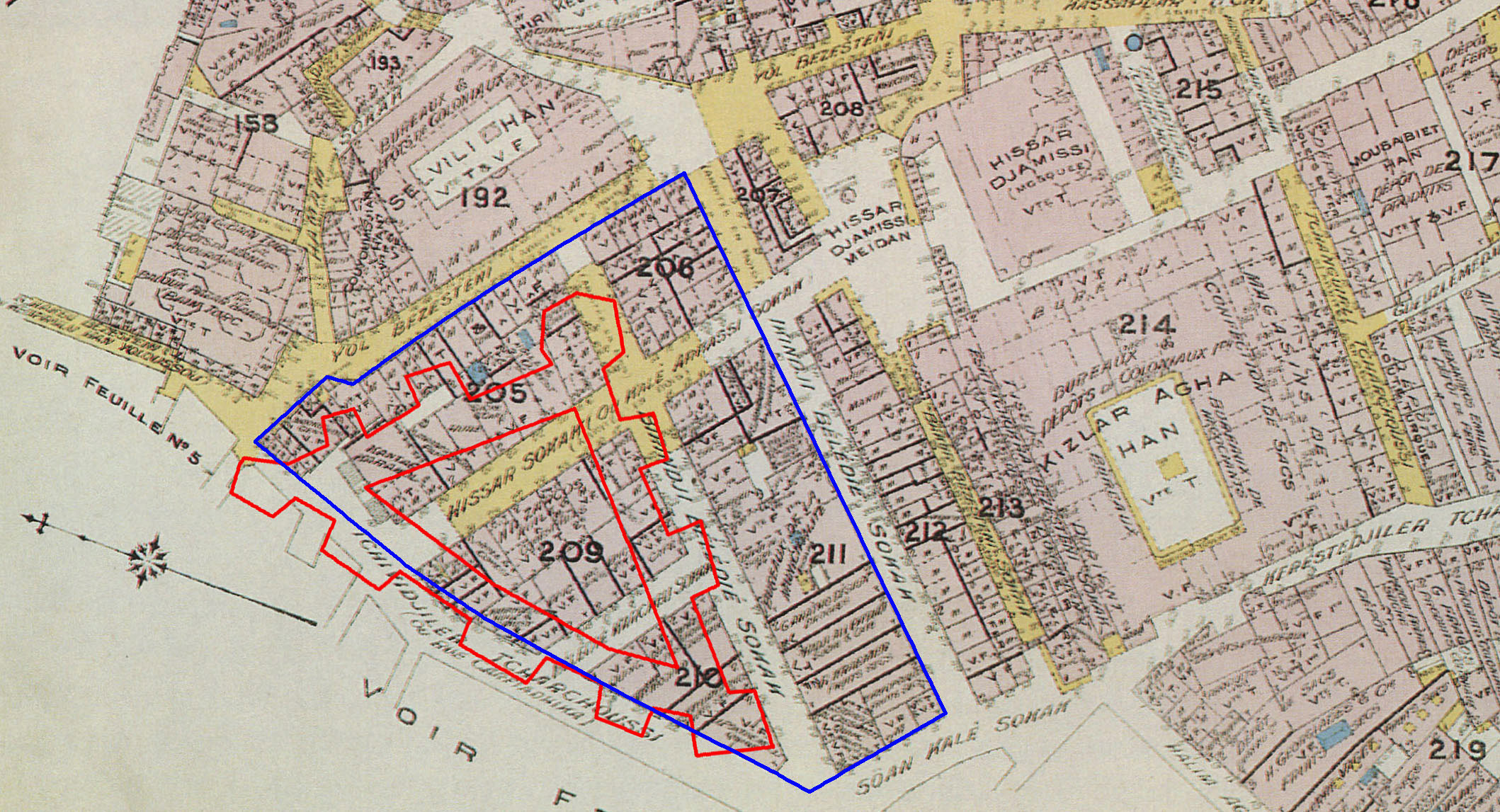 |
Projected onto the 1905 Goad fire insurance map, the outline in red is St. Peter’s castle according to Graves 1836, and in blue as projected from the Storari map. From the map prepared, the castle’s location in relation to Kızlar Agha Han, Hissar Djami and Selvili Han is clear, so the remains are likely to be from this structure. Analysis courtesy of George Poulimenos, 2012.
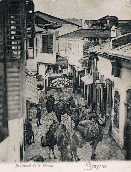 |
To give a flavour of what the nearby neighbourhood looked like: Rue de la Marine is an old name for Rue Eski Balouk Pazar, a continuation of Rue des Maltais to the south. Before the construction of the modern quay, this road ended in a small inlet of the main shore just before the old Customs, hence the name. St. Peter’s castle was just south of it, at the other side of the small inlet.