 |
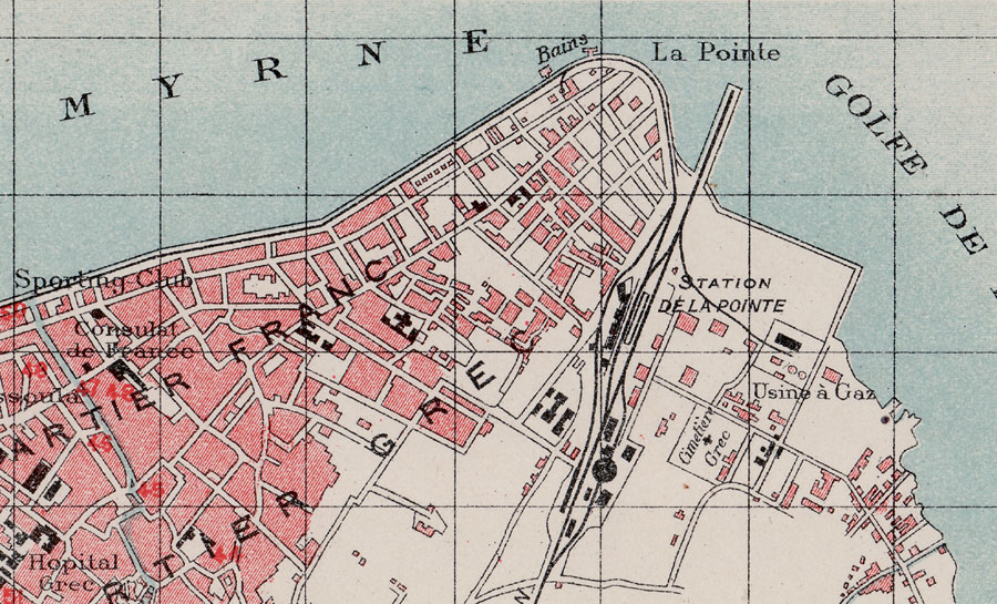
Part of a Baedecker map, used in tourist guides of about 1900-1910 showing the locaties of Punta and Daragatch of Smyrna.
To view a composite stitched up Pervititch map of Punta & Daragatch, made up of 16 individual maps (ca. 1923) arranged on a Google map, click here: (2.5 mb, please be patient) - work courtesy of George Poulimenos, 2011
To view a composite stitched up Pervititch map of Punta & Daragatch, made up of 16 individual maps (ca. 1923) arranged on a Google map, click here: (2.5 mb, please be patient) - work courtesy of George Poulimenos, 2011