The old map of Feriköy Protestant cemetery
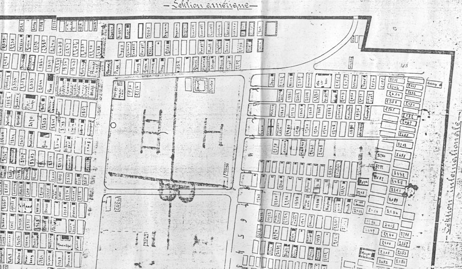 |
Following a rumour I discovered this hand drawn map of the Ferikoy cemetery, retained
in the archives of the Dutch consulate at Istanbul. Although there are few
clues on the map as to when, why and by who this was done. The sections below represent the corners of the map, that broadly represent the standing tombs till today, above the American and International and a portion of the German section.
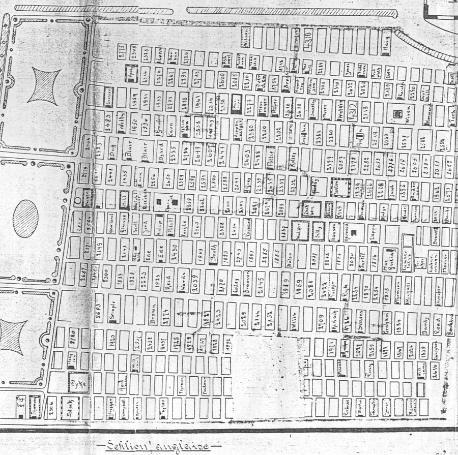 |
The British section.
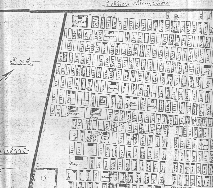 |
The German section bordering the walled section of the Armenian Protestant section.
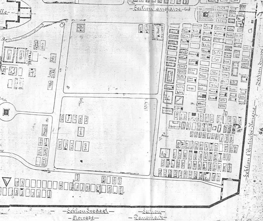 |
The Austro-Hungarian, Swiss, Scandinavian and edge of secondary British section.
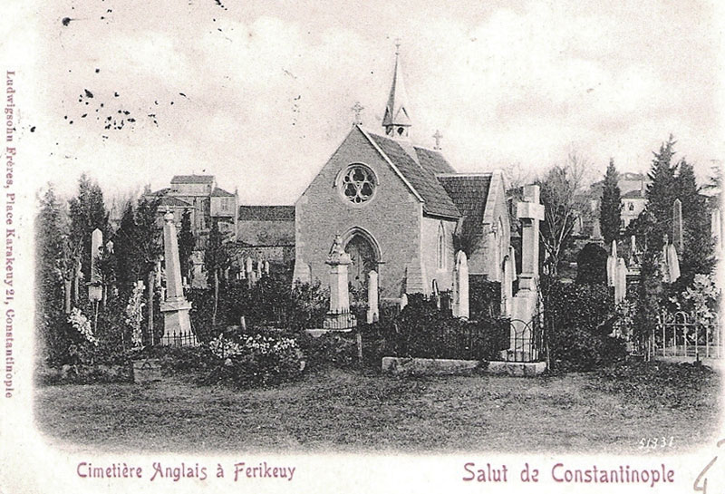 |
The view of the Protestant chapel at the centre of the cemetery - wrongly called the English cemetery on this postcard.